

Explore Discover Enjoy
Location 11: Prospect Row
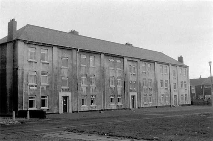
We now come to Silver Street which appears on Raine’s Eye Plan. The area east of Silver Street was known as the Hat Case, a very dilapidated area. After slum clearances; only the Waterman’s Tavern remained. Facing on to Silver Street and covering part of the Hat Case area, Harrison’s Buildings and Rickaby Flats were built (1903). These were the first Council Houses built in Sunderland. These were in turn demolished. In 1831, due to the deplorable living conditions, the inhabitants of Sunderland were easy prey to cholera. It attacked 538 persons of which 200 died. Jack Crawford was reported to be the second person to die. This outbreak lasted three months.
Edward Browne’s Mansion and Fitters Row: Edward Brown was a coal fitter (definition?) who accumulated a great deal of wealth as a broker who conducted the sale between coal pit owners and the ship owners that were shipping coal out of Sunderland. Through this lucrative occupation he was able to build a mansion in 1727, estimated to have cost around £5,000. He built this house along with a row of cottages for his fitters, known as Fitters Row. His house was renowned for its fine Georgian gardens and many Sunderland folk would visit his home to try and view this east end mansion.
However, Edward lost his wealth suddenly and would end his days as a pauper in Cork. The house he had built as a mansion would become tenement housing and house the poorest people of the parish. This area became slum housing and would be known as The Hat Case and Fitters Row. It is interesting that this one site reflects some of the changes and developments of the east end and it would later become the site of the first council flats to be built known as...
Harrison’s Buildings
In 1892 this area had been declared unfit and was recommended for demolition and clearance. In total, 49 houses and 120 dwellings would be removed leaving 460 people without a home. Harrison’s Buildings would be named after one of the councillors (Alderman Harrison chair of the Sanitary Committee.) The development would include Rickaby Street. These new homes were completed in 1903; it took over 10 years to make these homes a reality.
The site of Burleigh the Garth would eventually replace some of the older streets and east end housing such as Vine Street, Silver Street and Burleigh Street. It would be to the named after Mark Burleigh, a coalfitter, and one of the River Wear Commissioners. By 1779 about 50 properties had been built and Burleigh Street was described as having splendid three storey properties and mansions. These streets would become the site for one of the Garth developments in the late 1920s. The Garths were distinct communities within the East End. Derived from an old Norwegian word, ‘Garth’ describes an enclosed yard or garden. Burleigh Garth’s brown bricked tower blocks surround a large outdoor courtyard.
North Eastern Housing Association was set up by central government in 1936, to help and protect councils in the most impoverished areas from the expense of house-building. In its first two years it completed more than 2,000 homes in Sunderland. Most notable were the Garths, virtually the only case of a council estate in the central districts and a direct replacement for the east end “burgage plot” slums. These blocks were typical of their era, with long and heavy access balconies. The council built 4,800 dwellings 1919-45, of which 5% were tenements (small blocks of flats) and not popular. By 1966, of 20,800 post-war dwellings, 4,400 were tenements. R. Ryder, ‘Council house building’, 70; Robson, Urban Analysis, 96-7; Corfe, 77-8; Brett,108


